
Góra County topographic map
Interactive map
Click on the map to display elevation.
About this map
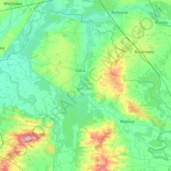
Name: Góra County topographic map, elevation, terrain.
Location: Góra County, Lower Silesian Voivodeship, Poland (51.48541 16.26780 51.78801 16.82877)
Average elevation: 99 m
Minimum elevation: 72 m
Maximum elevation: 206 m