
Mazarrón topographic map
Interactive map
Click on the map to display elevation.
About this map
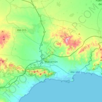
Name: Mazarrón topographic map, elevation, terrain.
Location: Mazarrón, Bajo Guadalentín, Región de Murcia, España (37.51728 -1.47576 37.72402 -1.20824)
Average elevation: 150 m
Minimum elevation: -1 m
Maximum elevation: 683 m