
Thank you for supporting this site ❤️
Make a donation
Make a donation
Gear up for your next adventure:
As an Amazon Associate, this site earns from qualifying purchases at no extra cost to you.
unknown topographic map
Click on the map to display elevation.
Thank you for supporting this site ❤️
Make a donation
Make a donation
Gear up for your next adventure:
As an Amazon Associate, this site earns from qualifying purchases at no extra cost to you.
About this map
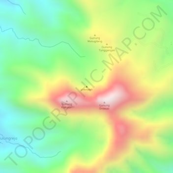
Name: unknown topographic map, elevation, terrain.
Location: unknown, Tulungrejo, Malang, East Java, 65391, Indonesia (-7.83451 112.41775 -7.83441 112.41785)
Average elevation: 1,207 m
Minimum elevation: 922 m
Maximum elevation: 1,568 m
Thank you for supporting this site ❤️
Make a donation
Make a donation
Gear up for your next adventure:
As an Amazon Associate, this site earns from qualifying purchases at no extra cost to you.