
Thank you for supporting this site ❤️
Make a donation
Make a donation
Gear up for your next adventure:
As an Amazon Associate, this site earns from qualifying purchases at no extra cost to you.
Kinyona topographic map
Click on the map to display elevation.
Thank you for supporting this site ❤️
Make a donation
Make a donation
Gear up for your next adventure:
As an Amazon Associate, this site earns from qualifying purchases at no extra cost to you.
About this map
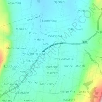
Name: Kinyona topographic map, elevation, terrain.
Location: Kinyona, Subukia ward, Subukia, Nakuru, Rift Valley, Kenya (-0.01651 36.21690 0.02349 36.25690)
Average elevation: 2,045 m
Minimum elevation: 1,974 m
Maximum elevation: 2,339 m
Thank you for supporting this site ❤️
Make a donation
Make a donation
Gear up for your next adventure:
As an Amazon Associate, this site earns from qualifying purchases at no extra cost to you.