
Thank you for supporting this site ❤️
Make a donation
Make a donation
Gear up for your next adventure:
As an Amazon Associate, this site earns from qualifying purchases at no extra cost to you.
Kaoma topographic map
Click on the map to display elevation.
Thank you for supporting this site ❤️
Make a donation
Make a donation
Gear up for your next adventure:
As an Amazon Associate, this site earns from qualifying purchases at no extra cost to you.
About this map
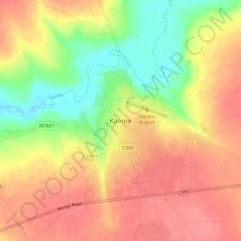
Name: Kaoma topographic map, elevation, terrain.
Location: Kaoma, Kaoma District, Western Province, Zambia (-14.83629 24.75700 -14.75629 24.83700)
Average elevation: 1,158 m
Minimum elevation: 1,117 m
Maximum elevation: 1,190 m
Thank you for supporting this site ❤️
Make a donation
Make a donation
Gear up for your next adventure:
As an Amazon Associate, this site earns from qualifying purchases at no extra cost to you.