
Long Lake topographic map
Click on the map to display elevation.
About this map
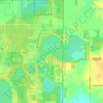
Name: Long Lake topographic map, elevation, terrain.
Location: Long Lake, Steuben County, Indiana, United States (41.74044 -84.81928 41.75250 -84.80600)
Average elevation: 321 m
Minimum elevation: 306 m
Maximum elevation: 335 m