Geolocate

Rihand Dam topographic map

Click on the map to display elevation.

About this map

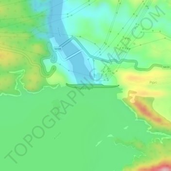
Name: Rihand Dam topographic map, elevation, terrain.

Location: Rihand Dam, Pipri, Dudhi, Sonbhadra, Uttar Pradesh, India (24.20276 83.00276 24.20344 83.01202)

Average elevation: 266 m

Minimum elevation: 195 m

Maximum elevation: 399 m

Gear up for your next adventure:

🥾Durable Hiking Shoes - Long-lasting shoes for frequent hiking
🧥Softshell Jacket - Windproof and breathable jacket for hiking
🪑Ultralight Camping Stool - Compact seating for rest stops during long hikes
🥾Trail Hiking Boots - Supportive boots for rough trails
🥾Trail Hiking Shoes - Durable shoes designed for rugged trails

As an Amazon Associate, this site earns from qualifying purchases at no extra cost to you.