
Thank you for supporting this site ❤️
Make a donation
Make a donation
Gear up for your next adventure:
As an Amazon Associate, this site earns from qualifying purchases at no extra cost to you.
Bouzbaier topographic map
Click on the map to display elevation.
Thank you for supporting this site ❤️
Make a donation
Make a donation
Gear up for your next adventure:
As an Amazon Associate, this site earns from qualifying purchases at no extra cost to you.
About this map
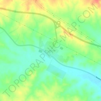
Name: Bouzbaier topographic map, elevation, terrain.
Location: Bouzbaier, Hassi R'Mel, Daïra Hassi R'Mel, Laghouat, Algérie (33.05019 3.46388 33.09019 3.50388)
Average elevation: 746 m
Minimum elevation: 721 m
Maximum elevation: 781 m
Thank you for supporting this site ❤️
Make a donation
Make a donation
Gear up for your next adventure:
As an Amazon Associate, this site earns from qualifying purchases at no extra cost to you.