Geolocate

Lexington topographic map

Click on the map to display elevation.

About this map

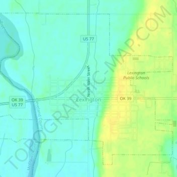
Name: Lexington topographic map, elevation, terrain.

Location: Lexington, Cleveland County, Oklahoma, 70351, United States (35.00367 -97.35473 35.02954 -97.31805)

Average elevation: 321 m

Minimum elevation: 312 m

Maximum elevation: 334 m

Gear up for your next adventure:

🔥Emergency Fire Starter - Reliable ignition source for all weather conditions
🥾Waterproof Hiking Boots - Essential footwear for rugged terrain and wet Canadian trails
🚲MTB Frame Bag - Carry tools and maps directly on your bicycle frame
🎒Fully Waterproof Backpack - Total protection for photography gear and electronics
🥽Outdoor Goggles - Protective eyewear for outdoor activities

As an Amazon Associate, this site earns from qualifying purchases at no extra cost to you.