Geolocate

Carova topographic map

Click on the map to display elevation.

About this map

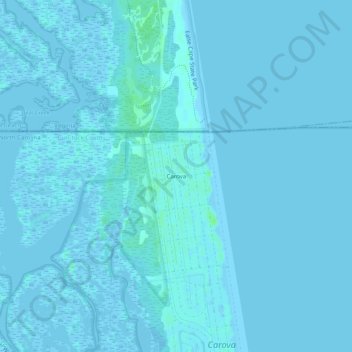
Name: Carova topographic map, elevation, terrain.

Location: Carova, Currituck County, North Carolina, United States (36.52540 -75.89220 36.56540 -75.85220)

Average elevation: 1 m

Minimum elevation: -3 m

Maximum elevation: 7 m

Other topographic maps

Click on a map to view its topography, its elevation and its terrain.

Gear up for your next adventure:

🚲MTB Frame Bag - Carry tools and maps directly on your bicycle frame
🏕️Camping Hammock - Integrated protection for sleeping between trees
🦟Insect Repellent - Keep mosquitoes and black flies away in wooded areas
🧢Hiking Sun Hat - Wide-brimmed protection for exposed mountain ridges
🧥Ultralight Puffy Jacket - Maximum warmth that packs down to the size of an orange

As an Amazon Associate, this site earns from qualifying purchases at no extra cost to you.