
Thank you for supporting this site ❤️
Make a donation
Make a donation
Gear up for your next adventure:
As an Amazon Associate, this site earns from qualifying purchases at no extra cost to you.
Bayaguana topographic map
Click on the map to display elevation.
Thank you for supporting this site ❤️
Make a donation
Make a donation
Gear up for your next adventure:
As an Amazon Associate, this site earns from qualifying purchases at no extra cost to you.
About this map
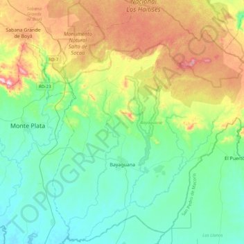
Name: Bayaguana topographic map, elevation, terrain.
Location: Bayaguana, Monte Plata, 51801, Dominican Republic (18.63858 -69.74573 18.99161 -69.36479)
Average elevation: 142 m
Minimum elevation: 7 m
Maximum elevation: 488 m
Thank you for supporting this site ❤️
Make a donation
Make a donation
Gear up for your next adventure:
As an Amazon Associate, this site earns from qualifying purchases at no extra cost to you.