Geolocate

Whiteriver topographic map

Click on the map to display elevation.

About this map
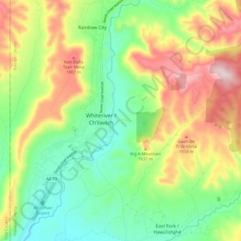
Name: Whiteriver topographic map, elevation, terrain.

Location: Whiteriver, Navajo County, Arizona, 85941, United States (33.79634 -109.99852 33.87662 -109.91923)

Average elevation: 1,708 m

Minimum elevation: 1,513 m

Maximum elevation: 2,004 m

Other topographic maps

Click on a map to view its topography, its elevation and its terrain.

Big A Mountain

United States > Arizona > Navajo County > Whiteriver

Average elevation: 1,693 m

Gear up for your next adventure:

🧥Fleece Jacket - Warm and lightweight jacket for layering
🥤Collapsible Travel Cup - Saves space and weight in your mess kit
🧣Evaporative Cooling Towel - Beat the heat during intense summer climbs
🏕️Camping Hammock - Integrated protection for sleeping between trees
⛺Lightweight Backpacking Tent - Compact tent for efficient hiking trips

As an Amazon Associate, this site earns from qualifying purchases at no extra cost to you.