
Thank you for supporting this site ❤️
Make a donation
Make a donation
Gear up for your next adventure:
As an Amazon Associate, this site earns from qualifying purchases at no extra cost to you.
Namgial topographic map
Click on the map to display elevation.
Thank you for supporting this site ❤️
Make a donation
Make a donation
Gear up for your next adventure:
As an Amazon Associate, this site earns from qualifying purchases at no extra cost to you.
About this map
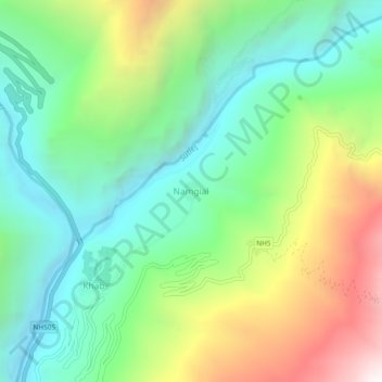
Name: Namgial topographic map, elevation, terrain.
Location: Namgial, Poo district, Kinnaur, Himachal Pradesh, India (31.78972 78.63630 31.82972 78.67630)
Average elevation: 3,169 m
Minimum elevation: 2,507 m
Maximum elevation: 4,450 m
Thank you for supporting this site ❤️
Make a donation
Make a donation
Gear up for your next adventure:
As an Amazon Associate, this site earns from qualifying purchases at no extra cost to you.