Geolocate

Dulao topographic map

Click on the map to display elevation.

About this map

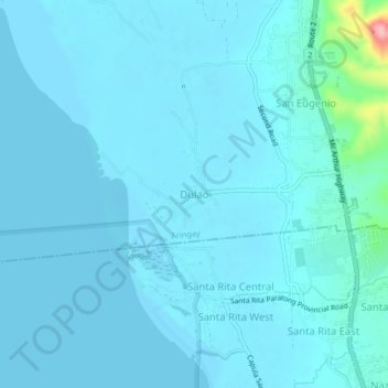
Name: Dulao topographic map, elevation, terrain.

Location: Dulao, Aringay, La Union, Ilocos Region, 2504, Philippines (16.34457 120.32212 16.38457 120.36212)

Average elevation: 11 m

Minimum elevation: -1 m

Maximum elevation: 159 m

Other topographic maps

Click on a map to view its topography, its elevation and its terrain.

Aringay River

Philippines > La Union > Aringay > Santa Lucia

Average elevation: 2 m

Gear up for your next adventure:

💧Collapsible Water Bottle - Space-saving water bottle for outdoor activities
🧣Merino Neck Gaiter - Protects against wind, sun, and cold at high altitudes
Tent Footprint - Protect tent floor and increase durability
🔦LED Headlamp - Hands-free lighting for early morning starts or late finishes
🦌Outdoor Trail Camera - Monitor wildlife activity near your favorite spots

As an Amazon Associate, this site earns from qualifying purchases at no extra cost to you.