Geolocate

Cares topographic map

Click on the map to display elevation.

About this map

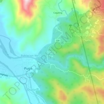
Name: Cares topographic map, elevation, terrain.

Location: Cares, Pugo, La Union, Ilocos Region, 2508, Philippines (16.30653 120.45697 16.34653 120.49697)

Average elevation: 173 m

Minimum elevation: 43 m

Maximum elevation: 493 m

Gear up for your next adventure:

Camping Coffee Maker - Brew fresh coffee anywhere on the topographic map
🥾Mountain Hiking Shoes - Shoes with superior grip for mountainous terrain
💡LED Camping Lantern - Illuminate your campsite with long-lasting lanterns
🥾Mountaineering Boots - Supportive boots for climbing and high-altitude hiking
Lightweight Backpacking Tent - Compact tent for efficient hiking trips

As an Amazon Associate, this site earns from qualifying purchases at no extra cost to you.