Geolocate

Trausella topographic map

Click on the map to display elevation.

About this map

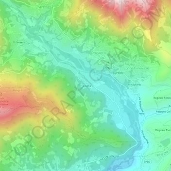
Name: Trausella topographic map, elevation, terrain.

Location: Trausella, Drusacco, Valchiusa, Torino, Piemonte, 10089, Italia (45.46996 7.74312 45.50996 7.78312)

Average elevation: 816 m

Minimum elevation: 568 m

Maximum elevation: 1,332 m

Gear up for your next adventure:

🕶️Polarized Sunglasses - Reduces glare from snow and water at high elevations
🛶Kayak Accessories - Essential gear for safe and fun kayaking adventures
🦟Insect Repellent - Keep mosquitoes and black flies away in wooded areas
🔋Lithium AA Batteries - Long-lasting power that performs in extreme cold
🥾Light Hiking Boots - Lightweight and comfortable boots for day hikes

As an Amazon Associate, this site earns from qualifying purchases at no extra cost to you.