Geolocate

Le Plessis topographic map

Click on the map to display elevation.

About this map
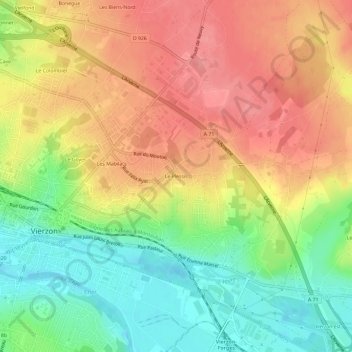
Name: Le Plessis topographic map, elevation, terrain.

Location: Le Plessis, Vierzon, Cher, Centre-Val de Loire, France métropolitaine, 18100, France (47.20797 2.07122 47.24797 2.11122)

Average elevation: 140 m

Minimum elevation: 95 m

Maximum elevation: 180 m

Other topographic maps

Click on a map to view its topography, its elevation and its terrain.

Étang des Forges

France > Centre-Val de Loire > Cher > Vierzon

Average elevation: 117 m

18100

France > Centre-Val de Loire > Cher > Vierzon

Average elevation: 131 m

Gear up for your next adventure:

🩹Compact First Aid Kit - Pre-packed essentials for common trail injuries
🧢Hiking Hat - Sun-protective and breathable hats for long treks
🧥Softshell Hiking Jacket - The perfect balance of wind protection and breathability
🥾Light Trekking Boots - Supportive boots for multi-day treks
🧭GPS Handheld Device - Reliable GPS navigation for outdoor adventures

As an Amazon Associate, this site earns from qualifying purchases at no extra cost to you.