
Thank you for supporting this site ❤️
Make a donation
Make a donation
Gear up for your next adventure:
As an Amazon Associate, this site earns from qualifying purchases at no extra cost to you.
Lambton topographic map
Click on the map to display elevation.
Thank you for supporting this site ❤️
Make a donation
Make a donation
Gear up for your next adventure:
As an Amazon Associate, this site earns from qualifying purchases at no extra cost to you.
About this map
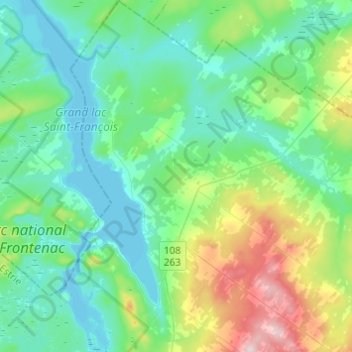
Name: Lambton topographic map, elevation, terrain.
Location: Lambton, Le Granit, Estrie, Quebec, G0M 1H0, Canada (45.78779 -71.16329 45.95738 -70.99016)
Average elevation: 348 m
Minimum elevation: 283 m
Maximum elevation: 572 m
Quebec trails, hiking, mountain biking, running and outdoor activities
Thank you for supporting this site ❤️
Make a donation
Make a donation
Gear up for your next adventure:
As an Amazon Associate, this site earns from qualifying purchases at no extra cost to you.