Geolocate

Gun River topographic map

Click on the map to display elevation.

About this map

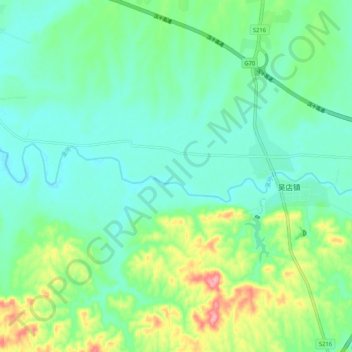
Name: Gun River topographic map, elevation, terrain.

Location: Gun River, Zaoyang City, Xiangyang, Hubei, China (31.97785 112.69088 31.99401 112.79458)

Average elevation: 118 m

Minimum elevation: 88 m

Maximum elevation: 200 m

Gear up for your next adventure:

👟Leg Gaiters - Keep debris, mud, and snow out of your boots
🧥Insulated Jacket - Keep warm in cold outdoor conditions
🥾Hiking Leggings - Comfortable leggings for outdoor activities
🥾Waterproof Hiking Shoes - Durable shoes for wet and rugged trails
🥾Trekking Boots - Durable boots for long-distance trekking

As an Amazon Associate, this site earns from qualifying purchases at no extra cost to you.