
Lac François topographic map
Interactive map
Click on the map to display elevation.
About this map
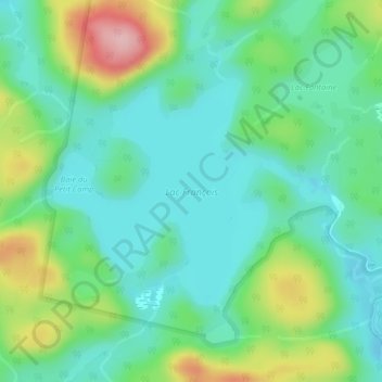
Name: Lac François topographic map, elevation, terrain.
Average elevation: 183 m
Minimum elevation: 131 m
Maximum elevation: 310 m
Other topographic maps
Click on a map to view its topography, its elevation and its terrain.
Zec Buteux–Bas-Saguenay
Canada > Québec > Charlevoix-Est > Baie-Sainte-Catherine
Zec Buteux–Bas-Saguenay, Baie-Sainte-Catherine, Charlevoix-Est, Capitale-Nationale, Québec, G0T 1A0, Canada
Average elevation: 220 m