Geolocate

Hürtgenwald topographic map

Click on the map to display elevation.

About this map

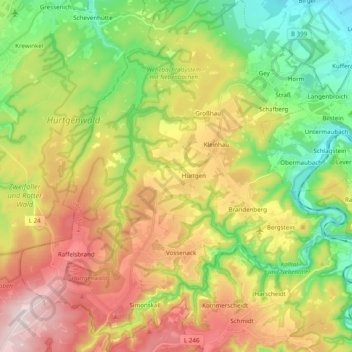
Name: Hürtgenwald topographic map, elevation, terrain.

Location: Hürtgenwald, Kreis Düren, North Rhine-Westphalia, 52393, Germany (50.65068 6.28446 50.77463 6.45883)

Average elevation: 335 m

Minimum elevation: 139 m

Maximum elevation: 593 m

Other topographic maps

Click on a map to view its topography, its elevation and its terrain.

Hambach

Germany > North Rhine-Westphalia > Kreis Düren

Average elevation: 111 m

Pier

Germany > North Rhine-Westphalia > Kreis Düren

Average elevation: 159 m

Duren

Germany > North Rhine-Westphalia > Kreis Düren > Duren > Duren

Average elevation: 135 m

Gear up for your next adventure:

🥾Waterproof Trail Shoes - Shoes designed to handle wet terrain
🧭GPS Handheld Device - Reliable GPS navigation for outdoor adventures
🧦Hiking Liner Socks - Thin base layer to prevent friction and blisters
🥾Lightweight Hiking Shoes - Comfortable shoes for day hikes
🌬️Windproof Camp Stove - Efficient cooking even on exposed mountain peaks

As an Amazon Associate, this site earns from qualifying purchases at no extra cost to you.