
Le Fourneau topographic map
Interactive map
Click on the map to display elevation.
About this map
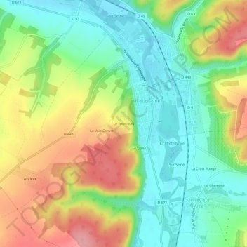
Name: Le Fourneau topographic map, elevation, terrain.
Average elevation: 197 m
Minimum elevation: 147 m
Maximum elevation: 270 m
Other topographic maps
Click on a map to view its topography, its elevation and its terrain.
La Foudre
France > Grand Est > Aube > Bar-sur-Seine
La Foudre, Bar-sur-Seine, Troyes, Aube, Grand Est, France métropolitaine, 10110, France
Average elevation: 199 m