Geolocate

Trenta topographic map

Click on the map to display elevation.

About this map

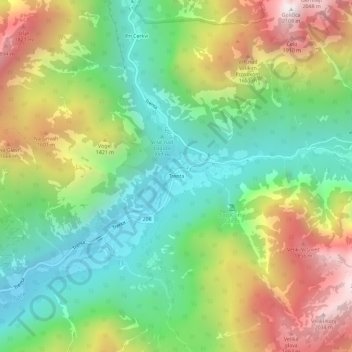
Name: Trenta topographic map, elevation, terrain.

Location: Trenta, Bovec, Slovenia (46.36081 13.73184 46.40081 13.77184)

Average elevation: 1,149 m

Minimum elevation: 557 m

Maximum elevation: 2,084 m

Gear up for your next adventure:

🛶Kayak Dry Bag - Waterproof storage for kayaking adventures
Camping Coffee Maker - Brew fresh coffee anywhere on the topographic map
🔥Emergency Fire Starter - Reliable ignition source for all weather conditions
🧰Emergency Multi-Tool - Compact multi-tool for outdoor survival
🧰Multitool Knife - Compact and versatile tool for outdoor use

As an Amazon Associate, this site earns from qualifying purchases at no extra cost to you.