Geolocate

Burnt Corn topographic map

Click on the map to display elevation.

About this map

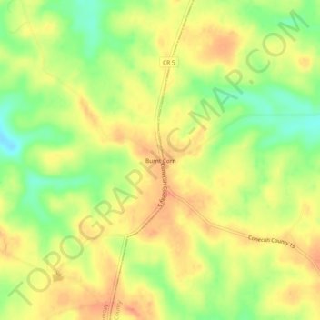
Name: Burnt Corn topographic map, elevation, terrain.

Location: Burnt Corn, Monroe County, Alabama, United States (31.53349 -87.18026 31.57349 -87.14026)

Average elevation: 120 m

Minimum elevation: 89 m

Maximum elevation: 143 m

Other topographic maps

Click on a map to view its topography, its elevation and its terrain.

Monroeville

United States > Alabama > Monroe County

Average elevation: 109 m

Peterman

United States > Alabama > Monroe County > Peterman

Average elevation: 70 m

Monroeville

United States > Alabama > Monroe County

Average elevation: 107 m

Gear up for your next adventure:

🔋Emergency Crank Radio - Weather alerts and power without needing batteries
🥾Trail Hiking Socks - Comfortable socks to prevent blisters and fatigue
🥾Mountain Hiking Shoes - Shoes with superior grip for mountainous terrain
🥾Mountaineering Boots - Supportive boots for climbing and high-altitude hiking
🥾Light Trekking Boots - Supportive boots for multi-day treks

As an Amazon Associate, this site earns from qualifying purchases at no extra cost to you.