
North Adams topographic map
Interactive map
Click on the map to display elevation.
About this map
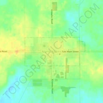
Name: North Adams topographic map, elevation, terrain.
Average elevation: 358 m
Minimum elevation: 344 m
Maximum elevation: 372 m
Other topographic maps
Click on a map to view its topography, its elevation and its terrain.
Moscow Township
United States > Michigan > Hillsdale County
Moscow Township, Hillsdale County, Michigan, 49257, United States
Average elevation: 348 m
Fayette Township
United States > Michigan > Hillsdale County
Fayette Township, Hillsdale County, Michigan, United States
Average elevation: 344 m
Allen Township
United States > Michigan > Hillsdale County
Allen Township, Hillsdale County, Michigan, 49227, United States
Average elevation: 328 m
Lewis Emery County Park
United States > Michigan > Hillsdale County > Hillsdale
Lewis Emery County Park, Hillsdale, Hillsdale Township, Hillsdale County, Michigan, United States
Average elevation: 346 m