

Niesen topographic map
Click on the map to display elevation.
Niesen
Der Niesengipfel ist bekannt für sein Panorama und ist ein beliebtes Ausflugsziel für Bergwanderer. 1856 wurde ein erstes Gasthaus auf Niesen Kulm erbaut. Die Gäste bestiegen den Niesen zu Fuss. Wohlhabende liessen sich von Pferden und Maultieren oder auf Sesseln, die von vier Männern getragen wurden, auf den Niesen bringen. Für die 1700 m Höhendifferenz, von Wimmis auf den Niesen, verdiente ein Träger 8 Franken am Tag. Ein Mietpferd kostete 15–20 Franken. Der Berg ist auch Motiv eines bekannten Aquarells von Paul Klee aus dem Jahr 1915.
About this map
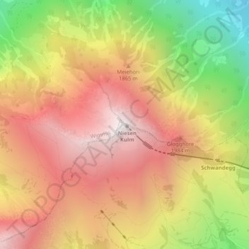
Name: Niesen topographic map, elevation, terrain.
Average elevation: 1,648 m
Minimum elevation: 705 m
Maximum elevation: 2,352 m
Other topographic maps
Click on a map to view its topography, its elevation and its terrain.

Kiental
Schweiz > Bern > Verwaltungskreis Frutigen-Niedersimmental > Reichenbach im Kandertal
Average elevation: 1,509 m
Kiental
Schweiz > Bern > Verwaltungskreis Frutigen-Niedersimmental > Reichenbach im Kandertal
Average elevation: 1,509 m