
Make a donation
Gear up for your next adventure:
As an Amazon Associate, this site earns from qualifying purchases at no extra cost to you.
Quiñales topographic map
Click on the map to display elevation.
Make a donation
Gear up for your next adventure:
As an Amazon Associate, this site earns from qualifying purchases at no extra cost to you.
About this map
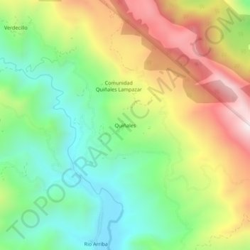
Name: Quiñales topographic map, elevation, terrain.
Average elevation: 2,207 m
Minimum elevation: 1,845 m
Maximum elevation: 2,726 m
Make a donation
Gear up for your next adventure:
As an Amazon Associate, this site earns from qualifying purchases at no extra cost to you.
Other topographic maps
Click on a map to view its topography, its elevation and its terrain.
Comarapa
Bolivia > Santa Cruz > Provincia Manuel M. Caballero > Municipio Comarapa
Se caracteriza por su topografía variada que comprende tres regiones, desde la alta serranía húmeda de la Siberia, los valles rodeados de montañas, y parte de las llanuras amazónicas. Pueblo tradicional de valle con sus características propias de la región.
Average elevation: 1,888 m
Pulquina
Bolivia > Santa Cruz > Provincia Manuel M. Caballero > Municipio Comarapa
Average elevation: 1,548 m
San Isidro
Bolivia > Santa Cruz > Provincia Manuel M. Caballero > Municipio Comarapa
Average elevation: 1,611 m