
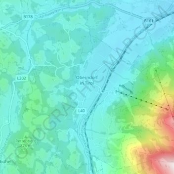
Gemeinde Oberndorf in Tirol topographic map
Interactive map
Click on the map to display elevation.
About this map
Name: Gemeinde Oberndorf in Tirol topographic map, elevation, terrain.
Average elevation: 823 m
Minimum elevation: 657 m
Maximum elevation: 1,821 m
Other topographic maps
Click on a map to view its topography, its elevation and its terrain.
Marktgemeinde Hopfgarten im Brixental
Autriche > Tyrol > Bezirk Kitzbühel
Marktgemeinde Hopfgarten im Brixental, Bezirk Kitzbühel, Tyrol, 6361, Autriche
Average elevation: 1,445 m