
Guhagar topographic map
Interactive map
Click on the map to display elevation.
About this map
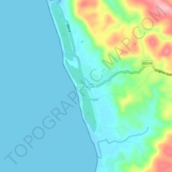
Name: Guhagar topographic map, elevation, terrain.
Location: Guhagar, Ratnagiri, Maharashtra, 415703, India (17.46352 73.17005 17.50352 73.21005)
Average elevation: 32 m
Minimum elevation: -1 m
Maximum elevation: 155 m