
Thank you for supporting this site ❤️
Make a donation
Make a donation
Gear up for your next adventure:
As an Amazon Associate, this site earns from qualifying purchases at no extra cost to you.
Sanguinheira topographic map
Click on the map to display elevation.
Thank you for supporting this site ❤️
Make a donation
Make a donation
Gear up for your next adventure:
As an Amazon Associate, this site earns from qualifying purchases at no extra cost to you.
About this map
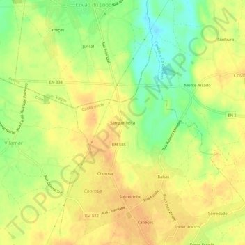
Name: Sanguinheira topographic map, elevation, terrain.
Location: Sanguinheira, Febres, Cantanhede, Coimbra, 3060-316, Portugal (40.40167 -8.65760 40.44167 -8.61760)
Average elevation: 60 m
Minimum elevation: 38 m
Maximum elevation: 73 m
Thank you for supporting this site ❤️
Make a donation
Make a donation
Gear up for your next adventure:
As an Amazon Associate, this site earns from qualifying purchases at no extra cost to you.