Geolocate

Rosebery topographic map

Click on the map to display elevation.

About this map

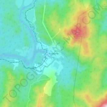
Name: Rosebery topographic map, elevation, terrain.

Location: Rosebery, Tasmania, Australia (-41.81869 145.50029 -41.73869 145.58029)

Average elevation: 359 m

Minimum elevation: 105 m

Maximum elevation: 1,090 m

Gear up for your next adventure:

👖Convertible Hiking Pants - Zip-off legs to adapt to changing weather conditions
🎒Backpack Rain Cover - External shield to keep your entire pack dry
💡Compact LED Flashlight - Powerful and portable flashlight for outdoor use
🧭Orienteering Kit - Tools for map reading and navigation in the wild
🧥Thermal Fleece Jacket - Versatile insulation for changing mountain temperatures

As an Amazon Associate, this site earns from qualifying purchases at no extra cost to you.