Geolocate

Warren topographic map

Click on the map to display elevation.

About this map
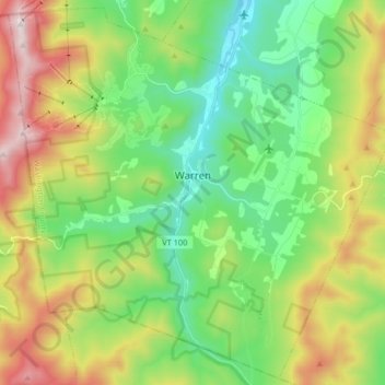
Name: Warren topographic map, elevation, terrain.

Location: Warren, Washington County, Vermont, 05674, United States (44.05188 -72.93408 44.16508 -72.77047)

Average elevation: 574 m

Minimum elevation: 221 m

Maximum elevation: 1,231 m

Other topographic maps

Click on a map to view its topography, its elevation and its terrain.

Mount Ellen

United States > Vermont > Washington County > Warren

Average elevation: 906 m

East Calais

United States > Vermont > Washington County > Calais

Average elevation: 336 m

Mount Ellen

United States > Vermont > Washington County > Warren

Average elevation: 906 m

East Calais

United States > Vermont > Washington County > Calais

Average elevation: 336 m

Gear up for your next adventure:

🧥Waterproof Pants - Keep dry during rainy hiking conditions
🚲MTB Frame Bag - Carry tools and maps directly on your bicycle frame
🎒Fully Waterproof Backpack - Total protection for photography gear and electronics
🧭GPS Outdoor Watch - Smart watch for navigation and fitness tracking in nature
💧Hydration Bladder - Hands-free hydration solution for long treks

As an Amazon Associate, this site earns from qualifying purchases at no extra cost to you.