
Tartane topographic map
Click on the map to display elevation.
About this map
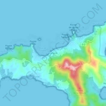
Name: Tartane topographic map, elevation, terrain.
Location: Tartane, La Trinité, Martinique, 97220, France (14.73942 -60.93734 14.77942 -60.89734)
Average elevation: 21 m
Minimum elevation: 0 m
Maximum elevation: 176 m
Other topographic maps
Click on a map to view its topography, its elevation and its terrain.
Réserve naturelle de la presqu'île de la Caravelle
France > Martinique > La Trinité
Average elevation: 17 m
Réserve naturelle de la presqu'île de la Caravelle
France > Martinique > La Trinité
Average elevation: 17 m