Geolocate

Cumaribo topographic map

Click on the map to display elevation.

About this map

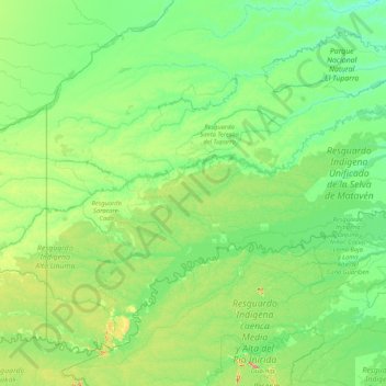
Name: Cumaribo topographic map, elevation, terrain.

Location: Cumaribo, Vichada, RAP Llanos, Colombia (2.73675 -71.07780 5.56445 -67.71012)

Average elevation: 140 m

Minimum elevation: 56 m

Maximum elevation: 869 m

Other topographic maps

Click on a map to view its topography, its elevation and its terrain.

Marandua

Colombia > Vichada > Puerto Carreño

Average elevation: 82 m

Gear up for your next adventure:

🕯️Camping Lantern - Illuminates your entire campsite with high-efficiency LEDs
🎒Backpack Rain Cover - External shield to keep your entire pack dry
🛌Down Sleeping Bag - Superior warmth-to-weight ratio for cold nights
🧭GPS Handheld Device - Reliable GPS navigation for outdoor adventures
🛏️Sleeping Bag - Warm and compact sleeping bags for outdoor camping

As an Amazon Associate, this site earns from qualifying purchases at no extra cost to you.