Geolocate

Sagat topographic map

Click on the map to display elevation.

About this map

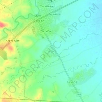
Name: Sagat topographic map, elevation, terrain.

Location: Sagat, Cordon, Isabela, Cagayan Valley, 3312, Philippines (16.64182 121.45134 16.68182 121.49134)

Average elevation: 111 m

Minimum elevation: 91 m

Maximum elevation: 152 m

Gear up for your next adventure:

Camping Coffee Maker - Brew fresh coffee anywhere on the topographic map
👟Trail Running Shoes - Agile footwear for fast-paced topographic exploration
🥾Light Hiking Boots - Lightweight and comfortable boots for day hikes
🥾Hiking Gaiters - Protect legs and shoes from mud, snow, and debris
🥾Waterproof Trail Shoes - Shoes designed to handle wet terrain

As an Amazon Associate, this site earns from qualifying purchases at no extra cost to you.