Geolocate

Bârda topographic map

Click on the map to display elevation.

About this map

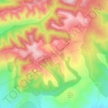
Name: Bârda topographic map, elevation, terrain.

Location: Bârda, Malovăț, Mehedinți, 227317, Romania (44.70988 22.68039 44.74988 22.72039)

Average elevation: 292 m

Minimum elevation: 127 m

Maximum elevation: 426 m

Other topographic maps

Click on a map to view its topography, its elevation and its terrain.

Strehaia

Romania > Mehedinți

Average elevation: 213 m

Malovăț

Romania > Mehedinți

Average elevation: 252 m

Svinița

Romania > Mehedinți

Average elevation: 378 m

Țigănași

Romania > Mehedinți

Average elevation: 73 m

Ilovu

Romania > Mehedinți

Average elevation: 241 m

Broșteni

Romania > Mehedinți

Average elevation: 232 m

Gruia

Romania > Mehedinți

Average elevation: 74 m

Balotești

Romania > Mehedinți

Average elevation: 212 m

Vânjuleț

Romania > Mehedinți

Average elevation: 90 m

Pristol

Romania > Mehedinți

Average elevation: 65 m

Bâcleș

Romania > Mehedinți

Average elevation: 269 m

Dubova

Romania > Mehedinți

Average elevation: 202 m

Drobeta-Turnu Severin

Romania > Mehedinți

Average elevation: 178 m

Gutu

Romania > Mehedinți

Average elevation: 294 m

Orșova

Romania > Mehedinți > Orșova

Average elevation: 245 m

Strehaia

Romania > Mehedinți

Average elevation: 213 m

Gear up for your next adventure:

🧭GPS Outdoor Watch - Smart watch for navigation and fitness tracking in nature
🧥Ultralight Puffy Jacket - Maximum warmth that packs down to the size of an orange
🚲Handlebar Phone Mount - View topographic-map.com live while cycling
🥾Mountain Hiking Shoes - Shoes with superior grip for mountainous terrain
🧥Thermal Layer - Insulating layer for cold outdoor conditions

As an Amazon Associate, this site earns from qualifying purchases at no extra cost to you.