Geolocate

Nahawan topographic map

Click on the map to display elevation.

About this map

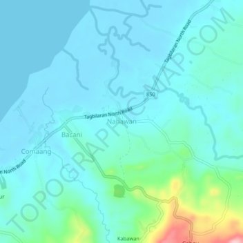
Name: Nahawan topographic map, elevation, terrain.

Location: Nahawan, Clarin, Bohol, Central Visayas, Philippines (9.94930 124.02891 9.98930 124.06891)

Average elevation: 28 m

Minimum elevation: -2 m

Maximum elevation: 185 m

Gear up for your next adventure:

🧶550 Survival Paracord - Versatile utility cord for emergency repairs and rigging
🥾Mountain Hiking Boots - High-traction boots for rocky terrain
🧢Hiking Sun Hat - Wide-brimmed protection for exposed mountain ridges
👖Convertible Hiking Pants - Zip-off legs to adapt to changing weather conditions
🦶Anti-Blister Balm - Prevents friction and hotspots during long ascents

As an Amazon Associate, this site earns from qualifying purchases at no extra cost to you.