Geolocate

Korla topographic map

Click on the map to display elevation.

About this map
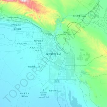
Name: Korla topographic map, elevation, terrain.

Location: Korla, Korla City, Bayingolin, Xinjiang, 841000, China (41.56387 86.01354 41.88387 86.33354)

Average elevation: 1,034 m

Minimum elevation: 898 m

Maximum elevation: 2,027 m

Gear up for your next adventure:

🥾Hiking Leggings - Comfortable leggings for outdoor activities
🕶️Polarized Sunglasses - Protect your eyes with durable polarized lenses
🧰Emergency Multi-Tool - Compact multi-tool for outdoor survival
❄️Traction Ice Cleats - Slip-on spikes for icy trails and winter hiking
🧥Softshell Hiking Jacket - The perfect balance of wind protection and breathability

As an Amazon Associate, this site earns from qualifying purchases at no extra cost to you.