
Thank you for supporting this site ❤️
Make a donation
Make a donation
Gear up for your next adventure:
As an Amazon Associate, this site earns from qualifying purchases at no extra cost to you.
Pozzuolo topographic map
Click on the map to display elevation.
Thank you for supporting this site ❤️
Make a donation
Make a donation
Gear up for your next adventure:
As an Amazon Associate, this site earns from qualifying purchases at no extra cost to you.
About this map
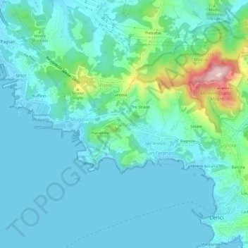
Name: Pozzuolo topographic map, elevation, terrain.
Location: Pozzuolo, Lerici, Follo, La Spezia, Liguria, 19032, Italy (44.06863 9.86914 44.10863 9.90914)
Average elevation: 48 m
Minimum elevation: -1 m
Maximum elevation: 288 m
Thank you for supporting this site ❤️
Make a donation
Make a donation
Gear up for your next adventure:
As an Amazon Associate, this site earns from qualifying purchases at no extra cost to you.