
Thank you for supporting this site ❤️
Make a donation
Make a donation
Gear up for your next adventure:
As an Amazon Associate, this site earns from qualifying purchases at no extra cost to you.
Iyasinen topographic map
Click on the map to display elevation.
Thank you for supporting this site ❤️
Make a donation
Make a donation
Gear up for your next adventure:
As an Amazon Associate, this site earns from qualifying purchases at no extra cost to you.
About this map
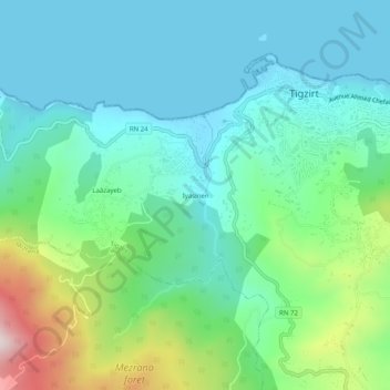
Name: Iyasinen topographic map, elevation, terrain.
Location: Iyasinen, Tigzirt, Tigzirt District, Tizi Ouzou, 15609, Algeria (36.86216 4.09226 36.90216 4.13226)
Average elevation: 137 m
Minimum elevation: 0 m
Maximum elevation: 566 m
Thank you for supporting this site ❤️
Make a donation
Make a donation
Gear up for your next adventure:
As an Amazon Associate, this site earns from qualifying purchases at no extra cost to you.