Geolocate

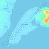
Limpapa topographic map

Click on the map to display elevation.

About this map

Name: Limpapa topographic map, elevation, terrain.

Location: Limpapa, Zamboanga City, Zamboanga Peninsula, 7000, Philippines (7.12989 121.88834 7.16989 121.92834)

Average elevation: 86 m

Minimum elevation: -1 m

Maximum elevation: 412 m

Other topographic maps

Click on a map to view its topography, its elevation and its terrain.

Sacol Island

Philippines > Zamboanga City

Average elevation: 6 m

Vitali River

Philippines > Zamboanga City > Mangusu

Average elevation: 27 m

Sinunug Island

Philippines > Zamboanga City

Average elevation: 0 m

Plaza Pershing

Philippines > Zamboanga City

Average elevation: 4 m

Gear up for your next adventure:

🩹Compact First Aid Kit - Pre-packed essentials for common trail injuries
🧼Travel Hand Sanitizer - Keep hands clean when water is scarce
🧴Sunscreen SPF - Broad-spectrum sunscreen for outdoor activities
🧳Compression Sacks - Maximize space in your backpack by shrinking gear
⛺Lightweight Backpacking Tent - Compact tent for efficient hiking trips

As an Amazon Associate, this site earns from qualifying purchases at no extra cost to you.