Geolocate

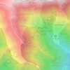
Shalkhai topographic map

Click on the map to display elevation.

About this map

Name: Shalkhai topographic map, elevation, terrain.

Location: Shalkhai, Battagram Tehsil, Battagram District, Hazara Division, Khyber Pakhtunkhwa, Pakistan (34.59486 73.02770 34.63486 73.06770)

Average elevation: 1,310 m

Minimum elevation: 1,123 m

Maximum elevation: 1,729 m

Other topographic maps

Click on a map to view its topography, its elevation and its terrain.
Gear up for your next adventure:

🧴Waterproofing Spray - Restore the DWR coating on jackets and tents
🔦LED Headlamp - Hands-free lighting for early morning starts or late finishes
🥾Mountaineering Boots - Supportive boots for climbing and high-altitude hiking
🧭GPS Tracker - Track your location in remote areas safely
🥾Lightweight Hiking Boots - Boots for comfort and mobility on long hikes

As an Amazon Associate, this site earns from qualifying purchases at no extra cost to you.