Geolocate

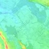
Nabas topographic map

Click on the map to display elevation.

About this map

Name: Nabas topographic map, elevation, terrain.

Location: Nabas, Oloron-Sainte-Marie, Pyrénées-Atlantiques, Nouvelle-Aquitaine, Metropolitan France, 64190, France (43.31495 -0.91077 43.34793 -0.87068)

Average elevation: 121 m

Minimum elevation: 76 m

Maximum elevation: 210 m

Other topographic maps

Click on a map to view its topography, its elevation and its terrain.
Gear up for your next adventure:

🥾Hiking Gaiters - Protect legs and shoes from mud, snow, and debris
🥾Waterproof Trail Shoes - Shoes designed to handle wet terrain
🔭Compact Monocular - One-handed bird watching and trail spotting
🔨Vehicle Emergency Tool - Safety tool for remote road trips to trailheads
🧊Portable Cooler - Keep food and drinks cold during outdoor adventures

As an Amazon Associate, this site earns from qualifying purchases at no extra cost to you.