Geolocate

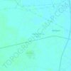
Devlapura topographic map

Click on the map to display elevation.

About this map

Name: Devlapura topographic map, elevation, terrain.

Location: Devlapura, Mehgaon Tahsil, Bhind, Madhya Pradesh, 477001, India (26.45506 78.76227 26.49506 78.80227)

Average elevation: 135 m

Minimum elevation: 122 m

Maximum elevation: 149 m

Other topographic maps

Click on a map to view its topography, its elevation and its terrain.

Siloli

India > Madhya Pradesh > Mehgaon Tahsil

Average elevation: 150 m

Meghpura

India > Madhya Pradesh > Mehgaon Tahsil > Meghpura

Average elevation: 157 m

Bahua

India > Madhya Pradesh > Mehgaon Tahsil > Bahua

Average elevation: 158 m

Vijaypura

India > Madhya Pradesh > Mehgaon Tahsil

Average elevation: 155 m

Pachera

India > Madhya Pradesh > Mehgaon Tahsil

Average elevation: 155 m

Kerora

India > Madhya Pradesh > Mehgaon Tahsil

Average elevation: 153 m

Gear up for your next adventure:

🥾Trail Running Boots - Durable shoes designed for trail running
💡LED Headlamp - Hands-free illumination for night hiking and camping
🥫Freeze-Dried Meals - Lightweight, high-calorie nutrition for multi-day treks
🧭Orienteering Kit - Tools for map reading and navigation in the wild
🥾Approach Boots - Comfortable boots for hiking and climbing approaches

As an Amazon Associate, this site earns from qualifying purchases at no extra cost to you.