Geolocate

Fada topographic map

Click on the map to display elevation.

About this map

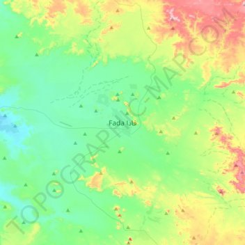
Name: Fada topographic map, elevation, terrain.

Location: Fada, Ennedi-Ouest, Chad (17.03306 21.42133 17.35306 21.74133)

Average elevation: 636 m

Minimum elevation: 502 m

Maximum elevation: 987 m

Gear up for your next adventure:

🥾All-Terrain Hiking Boots - Versatile boots for varied hiking conditions
🛶Canoe Life Vest - Safety vest for water sports
🧣Evaporative Cooling Towel - Beat the heat during intense summer climbs
🔋Lithium AA Batteries - Long-lasting power that performs in extreme cold
🧥Waterproof Hiking Jacket - Protect yourself from rain and wind while hiking

As an Amazon Associate, this site earns from qualifying purchases at no extra cost to you.