Geolocate

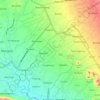
Genikan topographic map

Click on the map to display elevation.

About this map

Name: Genikan topographic map, elevation, terrain.

Location: Genikan, Magelang, Central Java, 56194, Indonesia (-7.44745 110.39207 -7.40745 110.43207)

Average elevation: 1,713 m

Minimum elevation: 1,333 m

Maximum elevation: 2,720 m

Other topographic maps

Click on a map to view its topography, its elevation and its terrain.
Kaliurang

Indonesia > Central Java > Magelang

Average elevation: 768 m

Salam

Indonesia > Central Java > Magelang

Average elevation: 284 m

Muntilan

Indonesia > Central Java > Magelang

Average elevation: 296 m

Kaliurang

Indonesia > Central Java > Magelang

Average elevation: 768 m

Ngablak

Indonesia > Central Java > Magelang

Average elevation: 629 m

Gear up for your next adventure:

🛶Kayak Dry Bag - Waterproof storage for kayaking adventures
🧢Beanie Hat - Keep your head warm in cold weather
🧦Outdoor Socks - Durable socks designed for hiking and outdoor sports
🔥Emergency Fire Starter - Reliable ignition source for all weather conditions
🍽️Titanium Camping Spork - Ultralight and indestructible eating utensil

As an Amazon Associate, this site earns from qualifying purchases at no extra cost to you.