
Mariscos topographic map
Interactive map
Click on the map to display elevation.
About this map
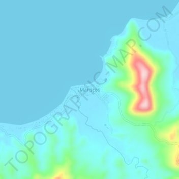
Name: Mariscos topographic map, elevation, terrain.
Location: Mariscos, Los Amates, Izabal, Guatemala (15.40445 -89.10155 15.44445 -89.06155)
Average elevation: 29 m
Minimum elevation: 0 m
Maximum elevation: 228 m
Other topographic maps
Click on a map to view its topography, its elevation and its terrain.
Chiriqui
Guatemala > Izabal > Los Amates > Chiriqui
Chiriqui, Los Amates, Izabal, Guatemala
Average elevation: 51 m
Los Amates
Guatemala > Izabal > Los Amates > Los Amates
Los Amates, Izabal, Guatemala
Average elevation: 114 m