Geolocate

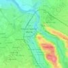
Bayerque topographic map

Click on the map to display elevation.

About this map

Name: Bayerque topographic map, elevation, terrain.

Location: Bayerque, Oloron-Sainte-Marie, Pyrénées-Atlantiques, Nouvelle-Aquitaine, France métropolitaine, 64400, France (43.16555 -0.63863 43.20555 -0.59863)

Average elevation: 238 m

Minimum elevation: 199 m

Maximum elevation: 318 m

Other topographic maps

Click on a map to view its topography, its elevation and its terrain.
Gear up for your next adventure:

🥾Trekking Boots - Durable boots for long-distance trekking
🔦LED Flashlight - Powerful and long-lasting flashlight for camping and emergencies
🧢Hiking Sun Hat - Wide-brimmed protection for exposed mountain ridges
🛶Kayak Dry Bag - Waterproof storage for kayaking adventures
🧶550 Survival Paracord - Versatile utility cord for emergency repairs and rigging

As an Amazon Associate, this site earns from qualifying purchases at no extra cost to you.