Geolocate

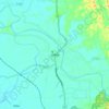
Camp 7 topographic map

Click on the map to display elevation.

About this map

Name: Camp 7 topographic map, elevation, terrain.

Location: Camp 7, Rohingya Refugee Camp in Bangladesh, Ukhia Upazila, Cox's Bazar District, Chattogram Division, Bangladesh (21.19870 92.15884 21.20940 92.17065)

Average elevation: 13 m

Minimum elevation: 0 m

Maximum elevation: 26 m

Other topographic maps

Click on a map to view its topography, its elevation and its terrain.
Gear up for your next adventure:

🥾Waterproof Hiking Boots - Essential footwear for rugged terrain and wet Canadian trails
🧊Insulated Water Bottle - Keeps drinks cold in summer and prevents freezing in winter
💧Filtered Water Bottle - Safe drinking water on the go
💧Reusable Water Bottle - Durable water bottles for hydration on trails
🧭GPS Tracker - Track your location in remote areas safely

As an Amazon Associate, this site earns from qualifying purchases at no extra cost to you.