Geolocate

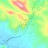
Popoyo topographic map

Click on the map to display elevation.

About this map

Name: Popoyo topographic map, elevation, terrain.

Location: Popoyo, Tola, Rivas, 48500, Nicaragua (11.47126 -86.13091 11.47461 -86.12566)

Average elevation: 9 m

Minimum elevation: -1 m

Maximum elevation: 91 m

Other topographic maps

Click on a map to view its topography, its elevation and its terrain.

La Flor

Nicaragua > Rivas

Average elevation: 46 m

Las Salinas

Nicaragua > Rivas > Las Salinas

Average elevation: 15 m

Gear up for your next adventure:

🔋Solar Power Bank - Keep your GPS and devices charged during long outdoor trips
🧴Insect Repellent - Protect yourself from bugs during outdoor adventures
🍽️Titanium Camping Spork - Ultralight and indestructible eating utensil
🔭Compact Binoculars - Lightweight optics for scouting trails and wildlife
🕶️Polarized Sunglasses - Reduces glare from snow and water at high elevations

As an Amazon Associate, this site earns from qualifying purchases at no extra cost to you.